〜The light and shadow of the system that created the city's framework〜
*This article is based on survey information as of February 2026.
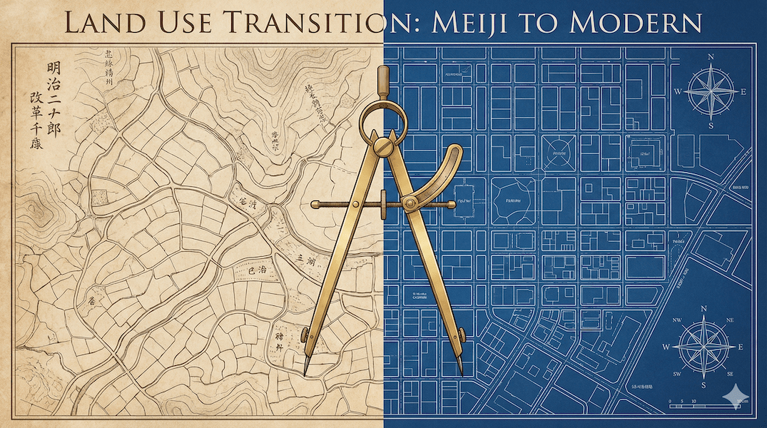
The city roads we use every day without even thinking about them, or the neatly divided residential areas, did you know that these familiar sights were actually created by applying "rice field shaping technology"?
According to documents from the Ministry of Land, Infrastructure, Transport and Tourism, approximately 30% of urban areas in Japan's urban planning areas have been developed using a method known as "land readjustment projects." This can be said to be a "mother tool" unique to Japan, and extremely unique even from a global perspective.
How did a rule invented in the Meiji era to maximize agricultural productivity transform into a powerful engine for reshaping cities? And now, as we enter a society of declining population, where is this engine headed?
This article delves deeply into the historical intersection of the Land Consolidation Act and the City Planning Act, which have existed since the Meiji period. Using maps and comparative data, it delves into the intricacies of land and systems that modern real estate owners and business people need to know.
1. The Dawn of Land Consolidation: The Struggle with Irregular Land
The original landscape of Japan in the early Meiji period
Let's start by turning back the clock to the early Meiji period. Japan had just begun to emerge as a modern nation, and the land that forms the foundation of the country still retained a strong trace of its origins from the Edo period.
The farmland of those days was not the neat rectangular shape we imagine today. It was made up of winding ridges that followed the natural topography and a complex web of drainage channels, making it extremely irregular and inefficient.
"Land is the source of all things" is an old economic adage, but for Japan at the time, this inefficient land shape was the biggest bottleneck hindering the nation's capital power (agricultural productivity).
Under these circumstances, voluntary local-level initiatives began in the 1870s (early Meiji period). In some advanced areas, farmers attempted to improve land accessibility by building roads and exchanging plots of land themselves. However, because these were based on private contracts, they faced the fatal limitation that "even one person opposed the project and it would not move forward."
1899: The invention of the "Land Consolidation Method"
In order to overcome this limitation and promote agricultural modernization under state leadership, the Cultivated Land Consolidation Act was enacted in 1899 (Meiji 32).
The groundbreaking features of this law can be summarized as follows:
- How forced participation works:A system in which even opposing landowners can be forced to participate in the project if a certain majority agrees (compulsory membership system).
- Land exchange system:Previous land rights can be "rewritten" into new, developed parcels through legal procedures.
In other words, this was the first time that a powerful system was established that prioritized the "public interest" of increased productivity over the "private right" of individual ownership. However, at this point, the law was strictly for "agriculture," and residential development was not its original purpose.
2. The Great Transition of 1909 and Urban Sprawl
The moment when farming methods turned into "alchemy"
However, times were changing rapidly. After the Russo-Japanese War (1904-1905), Japan shifted course toward heavy industrialization. People flocked to major cities like Tokyo and Osaka in search of work, resulting in a serious housing shortage.
At the time, Japan did not have a proper "City Planning Act" to control urban expansion. As a result, farmland on the outskirts of cities was converted into residential land in an uncontrolled manner, and "sprawl" (a phenomenon where houses are built side by side without roads or sewers) progressed.
[Map note: A town where farm roads have become alleyways]
Take a look at the Kyojima area in Sumida Ward, Tokyo, in the map above. There are many narrow, winding alleys, but this was not created haphazardly.The shapes of "paddy field ridges" and "waterways" were paved as roads and turned into residential areas, a remnant of this.is.
This is a typical example of urbanization while maintaining the structure of farmland (an organic form rather than a grid) through the Land Consolidation Act and simple development methods of the time.
In this crisis, landowners and developers are becoming aware of a fact that could be described as an "application of the law."
"If we use the Land Consolidation Act, which is designed to clear farmland, to reorganize the plots and build roads through them, wouldn't it be possible to use them as nice residential land?"
In response to this real-world pressure, the Cultivated Land Readjustment Act was significantly revised in 1909 (Meiji 42). This revision established "land use conversion" as a system, and expanded the scope for conversion to residential land under the pressure of urbanization. This led to the spread of a development method unique to Japan, which was nominally "cultivated land readjustment" but in reality was "residential land development."
The merits and demerits of the system's "twist"
This was a strange twisted phenomenon of "city building through farming," in which a technology originally intended for managing water (aqueduct networks) was applied to a technology for managing people and cars (road networks).
The diagram below shows the causal relationship of the "pressures and loopholes" that led to agricultural laws being used for urban development.
*Please scroll horizontally to view on your smartphone.
3. German Import: Lex Adickes' Impact
In 1919 (Taisho 8), Japan finally enacted a full-fledged "(Old) City Planning Law." In designing this system, the Ministry of the Interior bureaucrats at the time were strongly conscious of the "Lex Adickes" law, which had been enacted in 1902 by Franz Adickes, mayor of Frankfurt, Germany.
The Adikes Law was a system for reallocating land (pooling) in order to modernize cities. This system made it possible to secure public land for roads, squares, and other purposes. This idea of "reorganizing land for the public" has influenced the foundation of Japan's land readjustment system.
On the other hand, Japan did not simply copy the German method. Because the Japanese government at the time had little financial power, it placed emphasis on a system of union implementation in which the main actors were not only the government but also the people (landlords).
In other words, it was an improvement to a "self-sustaining" system in which landowners formed associations and sold part of their land (reserved land disposal) to earn money for construction. This enabled the government to develop infrastructure while reducing the injection of public funds, and created a structure in which landowners could profit from rising land prices.
*Frankfurt: Large-scale urban infrastructure development was carried out in the early 1900s under the Adikes Law.
The crucial difference between land consolidation and land readjustment
Let's clarify the difference between "arable land consolidation" and "land readjustment," which are often confused. The Land Readjustment Act was enacted as a separate law in 1954, after the war, and prior to that it was included in the old City Planning Act.
| Comparison items | [A] Arable land arrangement (~1949) | [B] Land readjustment (Old Metropolitan Planning Act 1919~ / Individual Act 1954~) |
|---|---|---|
| Main purpose | Improving agricultural productivity (Increased food production and efficiency) |
Creating healthy urban areas (Housing land supply and infrastructure development) |
| Technical features | "Water" Network (Irrigation and drainage channels play a key role) |
A network of roads (Road networks and city blocks play a key role) |
| Cost burden | Beneficiary burden (farmers) + Government subsidy |
Reserved land disposal fee (Self-construction using development profits) |
| Target area | Farmland (paddy fields and fields) | Land within urban planning areas |
*You can view the table by scrolling horizontally.
4. Contemporary Issues: "Reverse Land Readjustment" in Toyako, Hokkaido
A paradigm shift from "expansion" to "withdrawal"
Now, let's shift our perspective to the present day. The era in which "development is justice" has come to an end, and Japan has entered a period of serious population decline.
Especially in vast lands like Hokkaido, the huge grids (plots) drawn up during the Meiji era pioneering are now facing new challenges. As the number of farmers declines, the amount of abandoned, unmanaged farmland is increasing, while urban areas are becoming increasingly spongy with vacant houses.
In areas like Toyako Town, where international tourism resources and agriculture coexist, it can be said that there is no longer any need for the traditional land readjustment method of "destroying farmland and turning it into residential land." Rather, what is needed is technology to reconsolidate the scattered urban areas and reduce administrative costs.
Next-generation strategies: "Three-dimensional land exchange" and smart shrink
What is attracting attention in this regard is the application of "three-dimensional land exchange," a method of right conversion.
Normally, land readjustment involves the exchange of land for land, but multi-level land exchange involves the exchange of land rights for building floors (compartmental ownership rights). By applying this system, it may become technically possible in the future to consolidate landowners scattered across the suburbs into apartment complexes in town centers, and return deserted suburban land to farmland or green space.
The technology that once transformed farmland into a city can now be used to collapse a city and return it to nature. This concept of "reverse land readjustment (smart shrink)" is currently the subject of much discussion as an important proposal for creating sustainable local communities.
*Please scroll horizontally to view on your smartphone.
Conclusion: To master the "tool" known as the system
When we look back at the historical transition from the Land Consolidation Act to the City Planning Act, the greatest lesson we can learn is"Institutions are tools that can flexibly change their purpose to meet the needs of society."That is what it means.
A century ago, Japanese people repurposed agricultural techniques to build modern cities. So, we today can redefine land readjustment techniques, a legacy of the past, as a tool for "protection" and "regeneration" that can be adapted to a society with a declining population.
Now that the myth of ever-increasing growth has come to an end, we are at a stage where we must place the "quality" of our cities, rather than their "size," and "circulation" rather than "development," at the center of our blueprints. Understanding the history of past institutional formation will provide the most reliable compass for envisioning how to "build" and "protect" our cities in the future.
Related Links
- Ministry of Land, Infrastructure, Transport and Tourism: Overview of Land Readjustment Projects
- Ministry of Land, Infrastructure, Transport and Tourism: History of City Planning Legislation
- Ministry of Agriculture, Forestry and Fisheries: Land Improvement Districts and Land Improvement Projects
Inquiries and requests
We help solve local issues.
Please feel free to contact us even if it is a small matter.


